


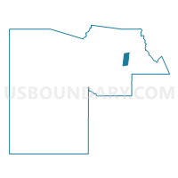
FORT MCDOWELL Voting District, Maricopa County, Arizona
About
Outline

Summary
| Unique Area Identifier | 524739 |
| Name | FORT MCDOWELL Voting District |
| County | Maricopa County |
| State | Arizona |
| Area (square miles) | 38.96 |
| Land Area (square miles) | 38.60 |
| Water Area (square miles) | 0.36 |
| % of Land Area | 99.07 |
| % of Water Area | 0.93 |
| Latitude of the Internal Point | 33.64616250 |
| Longtitude of the Internal Point | -111.65989540 |
Maps


Graphs
Select a template below for downloading or customizing gragh for FORT MCDOWELL Voting District, Maricopa County, Arizona


Neighbors
Neighoring Voting District (by Name) Neighboring Voting District on the Map
- FTN HILLS 2 Voting District, Maricopa County, AZ
- FTN HILLS 5 Voting District, Maricopa County, AZ
- FTN HILLS 9 Voting District, Maricopa County, AZ
- GOLDFIELD RANCH Voting District, Maricopa County, AZ
- HONDA Voting District, Maricopa County, AZ
- PINNACLE PEAK Voting District, Maricopa County, AZ
- PINNACLE SOUTH Voting District, Maricopa County, AZ
- RIO VERDE Voting District, Maricopa County, AZ
Top 10 Neighboring County Subdivision (by Population) Neighboring County Subdivision on the Map
- Phoenix CCD, Maricopa County, AZ (2,972,357)
- Tonto National Forest CCD, Maricopa County, AZ (9,713)
- Salt River CCD, Maricopa County, AZ (7,264)
Top 10 Neighboring Place (by Population) Neighboring Place on the Map
Top 10 Neighboring Unified School District (by Population) Neighboring Unified School District on the Map
Top 10 Neighboring State Legislative District Lower Chamber (by Population) Neighboring State Legislative District Lower Chamber on the Map
Top 10 Neighboring State Legislative District Upper Chamber (by Population) Neighboring State Legislative District Upper Chamber on the Map
Top 10 Neighboring 111th Congressional District (by Population) Neighboring 111th Congressional District on the Map
Top 10 Neighboring Census Tract (by Population) Neighboring Census Tract on the Map
- Census Tract 2168.18, Maricopa County, AZ (6,644)
- Census Tract 9413, Maricopa County, AZ (6,293)
- Census Tract 101.01, Maricopa County, AZ (5,073)
- Census Tract 101.02, Maricopa County, AZ (4,640)
- Census Tract 2168.20, Maricopa County, AZ (4,061)
- Census Tract 9412, Maricopa County, AZ (971)
- Census Tract 9807, Maricopa County, AZ (4)